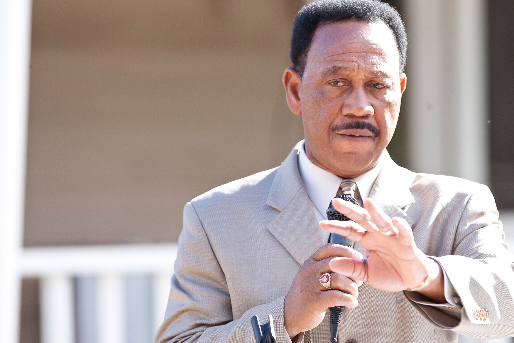
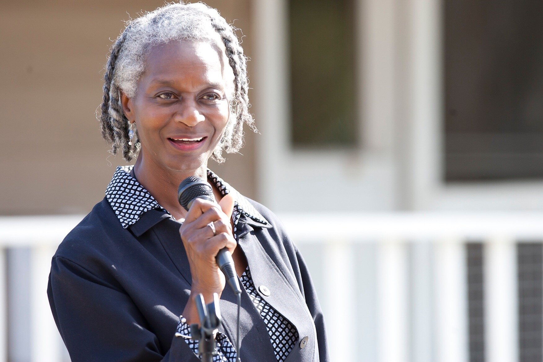
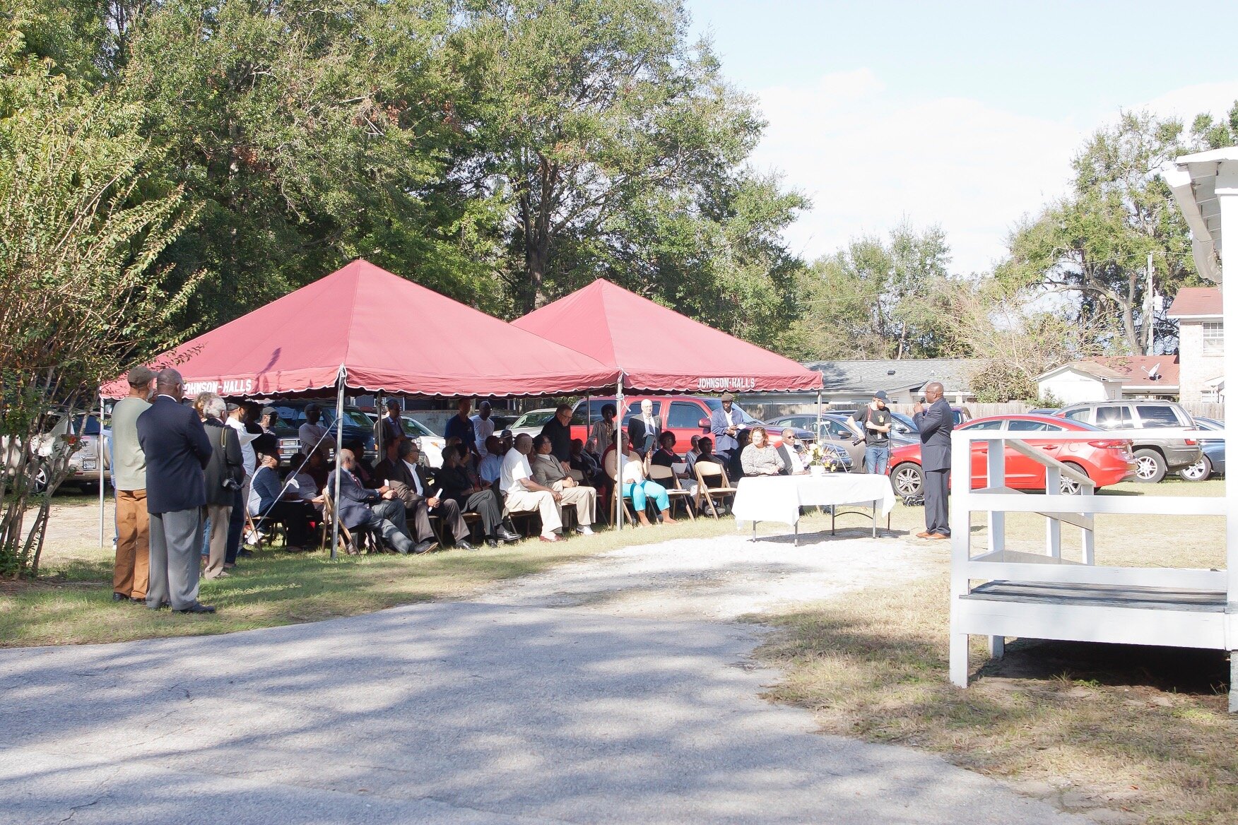
History
In early 2016 several Mt. Pleasant residents began meeting regularly for the purpose of protecting one of their historic African American communities from a major development which would have severely damaged the character, culture, history and affordability of their post Civil War community. The developer finally gave up and moved on. Many months later, in the afterglow of their success, they decided that the Charleston area African American settlement communities needed an advocacy group such as theirs, so they named themselves the African American Settlement Community Historic Commission (AASC), formed a Board, crafted a mission and became a 501C non-profit. Over the years they have gained the attention and respect of local, County and State governments, non-profits, and the general public and realized many notable successes.

What is a Settlement Community?
Settlement communities established after the Civil War and during the Reconstruction era, formerly enslaved African American purchased and settled on less than desirable land close to the Plantation on which they worked while creating their own self-sustaining communities on the waterways. Their self-taught skills and knowledge of crabbing, fishing, and shrimping provided food resource for their families. Generation later families continue to live in these communities.
They created farms, raising their own hogs, chickens, vegetables, fruits and nut trees. Usually a community Church would form, along with small stores, perhaps a dance hall, and a place for community meetings and celebrations. They built their own wood-framed homes, created their own cultures, music, religious customs, Gullah language and foods. Their values were based on harmony with nature and their fellow man.
Already efficient craftsmen, they were able to earn enough money to purchase land for their families to live on, often from former plantation owners, for $5-$10 per acre. You will find that most of the people living in the settlement communities today, can trace their ancestry all the way back to those initial families and are most often related to each other either by blood or marriage.

Today, settlement communities
look as rural as they did when first inhabited. As families have grown, some built additional homes or have added trailers to house their extended families…..some even forming family compounds. No matter what growth they experienced, their land still looks basically the same………..rural.
This is a far cry from crowded planned developments that are trying to overtake these valuable and historic lands. The demand for settlement community land and marsh severely threatens their way of life.
Land is the fabric that weaves the blacks together. They are land rich and very cash poor. All of the communities are Independent of one another. And within each tightly knit community, everyone looks out for everyone else.
Through the generations most of these lands were not formally transferred by wills and registered deeds, to the point that most of the community lands have become what is called “heirs properties.” This means that they have collective land ownership involving shares held by ancestors of previous landowners going back several generations. It is a long tradition that has worked well for the Gullah Geechee land owners until developers began picking them off for new housing and commercial communities. Heirs properties are a legal quagmire which have caused a lot of Gullah Geechee ancestral land owners to lose their properties for pennies on the dollar - gentrification. A local non-profit is striving to turn this situation around. The settlement communities generally remain in the County as opposed to annexing into the nearest towns because they believe that they have better control of their communities that way.
There are many, many African American settlement communities in the Charleston area. (see map of those in Charleston County). The African American Settlement Community Historic Commission has initially focused on four of these: Cainhoy, Scanlonville, Snowden and Phillips. These represent the communities that our initial Board members were from. As needs arise from other communities, we are ready to help.
Communities

Snowden
The origin of the Snowden name is unconfirmed. It was formed and settled after the Civil War by formerly enslaved people from surrounding plantations in the Long Point Road vicinity.
In Snowden, wood-framed houses, mostly built by Snowden residents, were one story with an attic usually used for children’s sleeping rooms. They had their own community grocery store, magistrate office, dance hall, chapel, and community meeting places. Roads were dirt until the 1970’s and electricity arrived soon thereafter. Public water arrived in the 1960’s and sewer was installed to some residents in 2008.
Snowden residents for the most part were farmers and still farm much of their lands today. There are about 300 households in Snowden. They run the gamut from babies to folks in their 90’s whose minds are still quite sharp. Most of the residents are related and many can trace their lineage back to post Civil War.
Religious activities centered primarily around Long Point Baptist Church and Olive Branch Church and now the Snowden residents have their own community center with its own basketball court.
Snowden is known for it’s Thanksgiving Day Parade, softball games, fun day for kids and family day.
Snowden has the unique situation in that it’s early 1900’s school house,

The Long Point Road School
Snowden has the unique situation in that it’s early 1900’s school house, is still standing and in good enough shape to be moved to a safe location.
The Long Point Road School, is still standing and in good enough shape to be moved from the private property on which it stands to the Snowden Community Center property. It will be restored and converted into a much-needed cultural center. College of Charleston’s Historic Preservation Director and some of his graduate students documented the school as Snowden at some point would like to nominate it to be listed on the National Register of Historic Places. The school was established to help provide education to African American children during segregation. This is the last standing African American school East of the Cooper. The school closed in the early 1953 when the new Jenny Moore Elementary school opened. Many former students still live in Snowden today.

Scanlonville
is situated on a large swath of land on the Southwest tip of Mt. Pleasant along the Cooper River in an area that at one time was Remly’s Plantation. The settlement possibly had the first ferry connecting East Cooper to Charleston.
It was created by Robert L. Scanlan, most likely a former slave & freedman carpenter who purchased the 600 acre property for $6K in an 1868 auction in trust for the Charleston Land Company – the goal of which was to help blacks obtain property. By 1870 the land had been designed and platted into one half acre town lots and two acre, 800 feet deep, farm lots. With the purchase of a land plot, the Charleston Land Company provided health care and helped settle marital and home disputes.
The current neighborhood Civic Club President, Ed Lee, states that Scanlonville was born out of necessity. The residents grew their own food, provided their own healthcare, their own economic system and even their own entertainment. Scanlonville had a rich history of entertainment and social gathering spots such as the largest of them all, Riverside Beach Pavilion, where music legends such as Duke Ellington, James Brown, Count Basie and Louis Armstrong, among others, would regularly perform. Riverside was the only black beach available in Mt. Pleasant.
Scanlonville annexed into the Town of Mount Pleasant in 1983.
Burial grounds are one of the most important concerns in the Settlement Communities. One of the most difficult and controversial situations that Scanlonville has faced is protecting an 130 year old gravesite in a heated legal battle between the East Cooper Civic Club and a couple who purchased the cemetery property and the 3.8 acres adjacent to the cemetery which was thought to be abandoned and contain very few graves. A study commissioned by the East Cooper Civic Club revealed that the cemetery contained up to 2,000 African American graves.
The couple intended to move the graves, clear the land and build a large house on it. The case went to trial in 2005 and settled in favor of the East Cooper Civic Club community with the judge saying that the “graveyard has been dedicated to the public and not abandoned.”…….”that the cemetery was in the public domain and could not be developed.” The Scanlonville Cemetery is included on the National Register of Historic Places.

They have an historic marker at the entrance to their community and annually celebrate Spring Flower Day to publicly acknowledge gratitude for their ancestors.
A more recent victory for Scanlonville was when it was deeded a ½ acre of land at the entrance to their community on Mathis Ferry Road. The land had originally belonged to Scanlonville, was purchased by the Town of Mt. Pleasant for a new fire station which didn’t materialize and then was sold to the East Cooper Land Trust for $10. Scanlonville believed that the property was rightfully theirs, and after much local tension and publicity, the property was returned to the community and the East Cooper Civic Club. The Community is in the process of developing a passive park in remembrance of Mt. Scanlon and past leaders of the community.
The East Cooper Civic Club, comprised of Scanlonville residents, is a very active/involved civic club which regularly successfully takes on neighborhood issues with the Town and County governments.
The community is eligible for nomination to the National Register of Historic Places.
Phillips

The Phillips Community was established by freedmen in 1875 along Horlbeck Creek which feeds into the Wando River. After the Civil War, freedmen, who used to work on the Phillips and other surrounding Plantations, purchased land in segments of 8.5 10, 15 and 25 acres at $10 per acre. A community was formed which now is 450 acres and has about 300 homes in it. Seafood from a near-by creek and produce from their farms made them a totally self-sufficient community. Descendants of the original residents still own these parcels today and their lands still occupy the footprint of the original 550-acre settlement.
When first formed, Phillips residents set up their own community organization called The Society and held their meetings in Society Hall for the purpose of helping those in need, who were sick, needed help planting or fixing a road or other community issues, adding to the strength of being totally self-sustainable. Several other short-lived community associations formed over the years but didn’t last. 20 years ago, the Phillips residents created the Phillips Community Association which is still active and successful. The Association now owns 10 acres, with a conservation easement on all, where the original Society Hall used to be and have plans to build a new Community Center. Everyone still looks out for everyone, they raise money for community needs, hold pot luck dinners, dances, flea markets and at the end of the summer hold their annual Family Day. Family Day, to which they invite former residents, friends from surrounding communities and organizations, is for fellowship, to thank supporters and recognize people who work in the Community to help keep it clean and safe. They also give out school supplies for returning Fall students.
Phillips residents originally used a cemetery on Parker’s Island which is now the Rivertown development. Today only 4 graves are evident on this historic property and Rivertown maintains it as open space.
Many Phillips people lived and worked on Parker’s Island making bricks and harvesting pecans. Their residents eventually decided to purchase property and move to Phillips. In the early 1900’s Phillips helped establish the Goodwill AME Church and they use the Goodwill cemetery instead of Parker’s Island.
In order to connect Christ Church Parish (most of the old Mt. Pleasant) with St. Thomas’s Parish (now Cainhoy), Gregorie’s Ferry Road ran from the Wando River ferry station, through what is now Park West and Dunes West, around the North side of Phillips and through Laurel Hill Plantation. This ferry was eventually replaced by the Wando River Bridge. When the State of SC decided to build Highway 6 connecting Cainhoy and Mt. Pleasant, they straightened the road and built it straight through the middle of the Phillips community. Now half of Phillips was on the North side of Highway 6 and half on the South side of Highway 6. In 1942 the State of SC upgraded the dirt road, State Highway 6, to a paved road and called it Highway 41.
There were no traffic congestion issues on Highway 41 until the proliferation of upscale development (Park West, Dunes West, Rivertown etc) up and down the highway on either side of Phillips. Now the County Transportation Department is seriously considering widening the Highway from 2 to 5 lanes to help increase traffic throughput. The Town of Mt. Pleasant and the new developments vigorously support widening the highway and are scarcely considering the effect on Phillips. Phillips residents live along Highway 41 on ancestral lands, which in most cases is heirs property. The residents will tell you that if they lose their land they have can’t afford to stay in Mt. Pleasant.
Phillips would prefer that the State just widen Highway 41 to 3 lanes, but that is not an option. Phillips supports an alternative solution which calls for building a new road around Park West and Dunes West with no penetration into Phillips. The County Transportation Department is considering the pro’s and con’s of each alternative. The Charleston County Transportation Department and the Army Corps of Engineers will determine the best solution and the Army Corps will make the final decision.
Before all this development, Phillips land never flooded, even with historic level rain. They were protected by all the open land and marsh around them. Now the new developments have destroyed the “sponge” effect of the open land and Phillips floods regularly.
Because of taxes, impact fees and other things which are unaffordable and unsustainable, Phillips continues to want to remain in the County, not the Town of Mt. Pleasant.
Phillips is eligible for listing on the on the National Register of Historic Places.


Jack Primus is in the Wando section of an area known as Cainhoy and is bounded by three rivers, Wando on the East (named after the Wando Indians), Cooper River on the South, and the East Branch of the Cooper River on the West.
Archeological studies reveal evidence of 4,000-5000 year old pottery, Civil War relics, English pottery and 250-500 year old brick kilns which could fire 5K – 10K bricks at a time. Kilns contributed significantly to the reconstruction of Charleston after hundreds of wood houses burned in the 1700’s and 1800’s. Because of so many destroyed wooden houses, bricks became in extreme demand.
This area was home to free as well as enslaved people. At the end of the Civil War, many freed blacks in the Wando area, purchased land close to the plantations on which they had worked. Their familys’ lineage, heritage and lands still exist today. One of these communities is Jack Primus, which wraps around the old Venning Plantation. The origin of the name Jack Primus is not known for sure, however, a well-respected local historian’s research found that in 1712, a “free black man” named Jack Primus, purchased 100 acres in this very area.
These freedmen communities were pretty much self-sustaining, however, the locals would frequently take barges into Charleston filled with cotton, firewood, and vegetables and return with necessities needed in the “country”.
In 1926 every family in Wando-Cainhoy helped construct the Keith School on land donated by African American resident, Edward Keith, Sr. The walk to school for long distances on cold winter days was tough, so residents lit fires in steel drums stationed on Clements Ferry Road allowing the children to warm their hands as they passed by. The school remained in use until 1956 when Berkeley County built a new elementary and high school. Hurricane Hugo destroyed the building in 1989. The Community built a new “school/museum/meeting center” right next to the still existing school foundation.
In the 1930’s Harry Frank Guggenheim purchased the old Venning Plantation and renamed it the Cainhoy Plantation and used it for his Northeastern friends to come down and hunt game. The Venning Cemetery, used during slavery, is still in use by and owned today by the Jack Primas Community. Community leaders are in in the process of applying for it to be listed on the National Register for Historic Places.
Prior to the 1992 extension of the Mark Clark Expressway to Highway 17 in Mt. Pleasant, Clements Ferry, very close to Jack Primus and the Cainhoy Plantation, was a quiet road. The Expressway created two new interchanges, allowing traffic to flow north on Clements Ferry to Wando, Cainhoy and Huger and south to St. Thomas and Daniel Island. Jack Primus and Cainhoy lost their country/rustic feeling and atmosphere…….forever.
In the early 2000’s the State Port Authority purchased around 40 acres on Daniel Island so that they could built their new “Global Gateway” port, which would entail running trucks and a railroad through the middle of Cainhoy. This spawned the formation of a black and white Wando-Huger Community Development Corp to fight the port plan. They won and the SPA was forced to find another location for their terminal.
Charleston County is in the pre-construction phase of widening Clements Ferry Road. Jack Primus residents are in the process of ensuring that they get the highest value possible for the land they own along Clements Ferry Road.
Another huge challenge for this area is to protect as much as possible of the 9K acres of the Guggenheim Cainhoy Plantation from development. Local and State historic, environmental and African American advocacy groups are making good progress to preserve as much of this property as possible and ensure that results of the development do as little harm to their property and environment as possible.
Jack Primus is now home to about 200 residents living in around 80 homes.
Current Priorities
▻Protecting historic lands from the planned 9K housing unit development
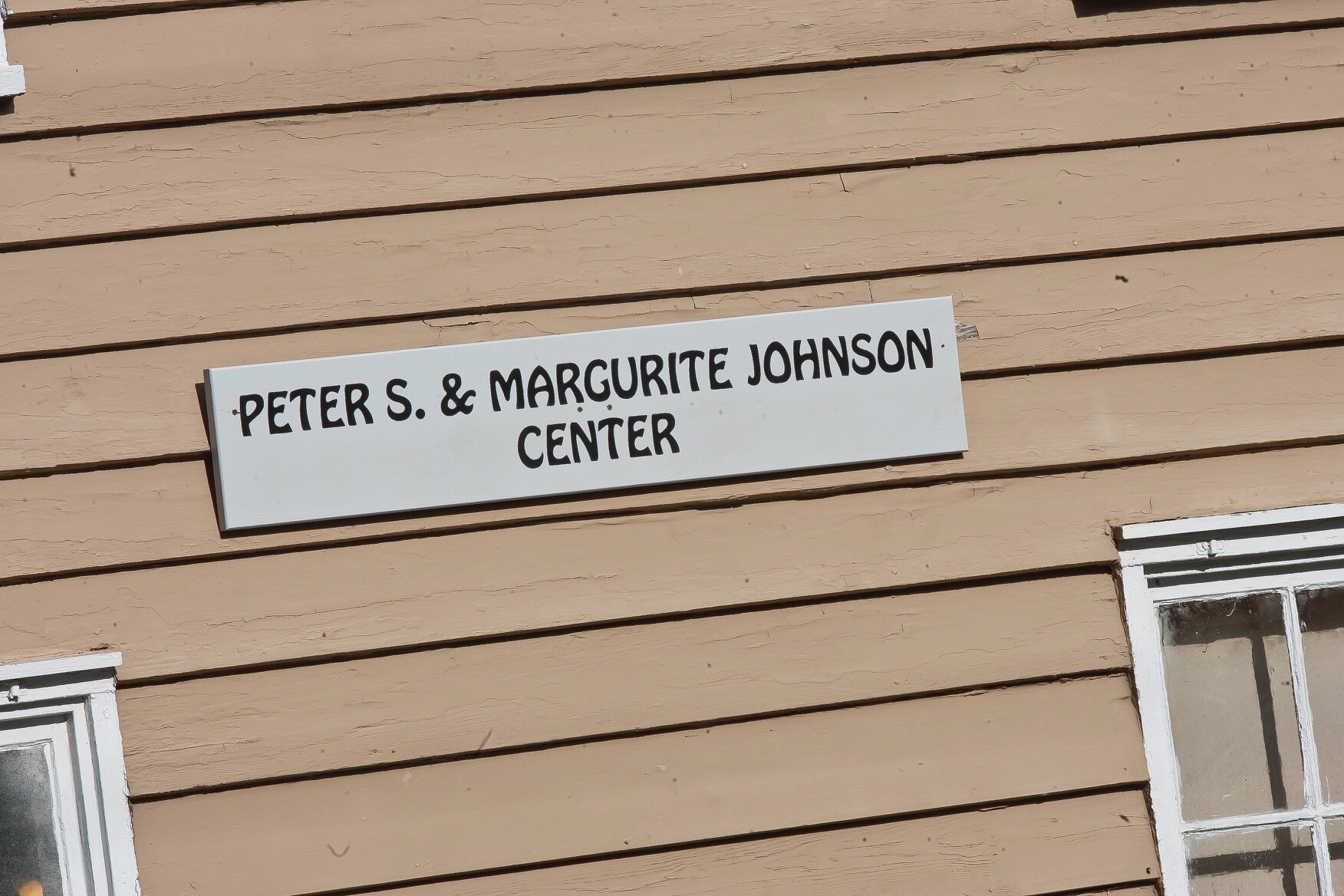
History Of Headquarters

Born in 1902, Miss Margurite and her husband, Peter, were staples in the Old Village African American community of Mt. Pleasant. Married in 1918, they purchased a funeral home in 1929 and named it the Johnson Funeral Home……one of the first black owned businesses in the area. “Funeral directing during this time, was a highly respected position in the African American community and undertakers were often among the wealthiest and most influential men in Negro Society.” (Suzanna E, Smith Miles, “To Serve the Living: Funeral Directors and the African American Way of Death, Cambridge: Belknap Press of Harvard University Press, 2010. Proquest. 80). Margurite, who owned a laundry service, learned how to be a mortician from her husband and after his death in 1953, was the “only lady mortician in Mt. Pleasant.”
Their home at 440 Venning Street was constructed in the Lowcountry single vernacular style of architecture in the late eighteen hundreds. The brick chimney appears to be a remnant of an earlier structure. It was much simpler than other houses in the Old Village. Over the years bathrooms were added and some ceilings and floors were covered. The Venning Street area dates back to the 1837 founding of the Village of Mount Pleasant, part of historic Christ Church Parish.

In her oral history Margurite reminisced that when she was young “black and white children played together and the people were all friendly”. “We never had crime and I never saw children act like they do nowadays. They are so rude and have little respect for their elders or their teachers.” “When we misbehaved in school we got skinned at home. We went to school to learn and most of us learned more in eight years than these children do today in twelve. She remembered when the 1911 hurricane blew down the Friendship AME Church.
Margurite could remember when “Mr. Moissner ran the German Bakery, Mr. Tinken had a big store, Mr. Weinhammer had a grocery and clothing store. Phillip Oree ran the colored market. “Our doctors were Dr. Bowens and Dr. Reampton and the Druggist was Dr. Husmacker”. “We had a shoemaker who could really make a shoe in those days……..not just repair one.”
The Johnsons were truly dedicated to their community. Margurite was a member of the Democratic Women’s Society, WIRE, Board member of the Friendship AME Church and prior to ownership of the funeral home, owned her own laundry business. Peter was a member of the Elks Club, on the Board of the Friendship AME Church, and a charter-founding member of the Mount Pleasant NAACP. He also conducted literacy classes for adults.
The AASC is very grateful that we can carry Margurite and Peter’s memories onward and we thank Mr. Halls of Johnson-Halls Funeral Home for his allowing us to use Miss Margurite’s former home as our headquarters building.

For more information about the Johnsons and their historic house, click here for a report created by Sada Stewart while a 2018 College of Charleston intern at the Historic Charleston Foundation.